Connect with us

Weather

IMD flags heavy rain, thunderstorm risk in 15 states

The IMD has issued a heavy rain and thunderstorm alert for 15 states including West Bengal, Bihar, Uttarakhand and the northeast, with wind speeds up to 70 kmph and landslide risk in hill states.

Published

on

The India Meteorological Department has flagged a heavy rain and thunderstorm risk across 15 states in its latest warning.

The states under alert include Bihar, Chhattisgarh, West Bengal, Nagaland, Manipur, Mizoram, Tripura, Assam, Meghalaya, Odisha, Uttarakhand, Himachal Pradesh, Jammu & Kashmir, and parts of eastern Uttar Pradesh and Madhya Pradesh.

Wind speeds of up to 70 kmph are expected, with hill states including Himachal Pradesh facing an increased chance of landslides.

The IMD noted that river levels are rising rapidly in many of the alerted states, a factor that could add to flooding risk in the coming days.

Hilly states including Himachal Pradesh, Uttarakhand and Jammu & Kashmir face an elevated risk of landslides and flash floods as rivers in several states are rising rapidly.

Southern India is expected to see comparatively subdued weather activity during this spell, with only isolated showers forecast rather than the widespread rain seen elsewhere.

The northeastern states of Nagaland, Manipur, Mizoram, Tripura, Assam and Meghalaya are all included in the alert, reflecting a broad band of monsoon activity stretching across the region.

Authorities in low-lying and hill-state districts have been advised to stay alert for waterlogging, landslides and possible disruption to road and rail traffic during the alert period.

The IMD’s warning system uses colour-coded alerts, with the current advisory urging residents in the affected states to exercise caution given the combination of heavy rain and strong winds.

A low-pressure area over southwest Uttar Pradesh and surrounding areas is expected to bring heavy to very heavy rainfall at isolated places in Uttarakhand and western Uttar Pradesh.

West Bengal is under a very heavy rain warning, with widespread rainfall expected across the Gangetic plains of the state from September 7 to 10.

Jharkhand is likely to see widespread rainfall from September 8 to 11, while Odisha’s spell is expected between September 10 and 12, according to the IMD’s regional outlook.

Monsoon clouds over Bengal, India, Wikimedia Commons, CC BY 2.0

Weather

Weather today: Delhi dry, three regions under rain watch

Delhi gets a break from rain with partly cloudy skies and highs of 31-33°C, even as the IMD flags isolated heavy showers in Uttarakhand, the Andaman and Nicobar Islands, and South Interior Karnataka on September 28.

Published

on

Delhi is dry today, September 28, with partly cloudy skies and highs of 31-33 degrees Celsius.

Three regions remain under a rain watch: Uttarakhand, the Andaman and Nicobar Islands, and South Interior Karnataka.

The IMD has flagged isolated heavy showers in these areas.

Delhi’s skies are expected to turn mainly clear from September 29.

Temperatures in Delhi are expected to rise further later in the week.

Isolated heavy rainfall remains possible in Uttarakhand despite the wider dry spell in northern India.

The Andaman and Nicobar Islands are also expected to see isolated heavy showers.

South Interior Karnataka has been flagged for isolated heavy rainfall as well.

The IMD’s forecasts are updated regularly as weather systems shift across the country.

Delhi’s weather has been mixed through September, alternating between rain spells and drier stretches.

Northern India as a whole has been seeing a gradual transition out of the monsoon season in late September.

Weather patterns can vary significantly across India on any given day given the country’s size and diverse geography.

The India Meteorological Department is the government’s nodal agency for weather forecasting and advisories.

Residents in regions with isolated heavy rain warnings are typically advised to stay updated on local alerts.

Uttarakhand’s hilly terrain makes it particularly prone to isolated but intense rainfall events during this period.

The Andaman and Nicobar Islands often see localised heavy rain due to their maritime location in the Bay of Bengal.

South Interior Karnataka includes districts that receive rainfall from both the southwest and northeast monsoon systems.

Delhi’s air quality can also be affected as the city transitions from the monsoon into the drier post-monsoon period.

The IMD typically issues day-wise forecasts covering temperature, rainfall probability and wind conditions for major cities.

Delhi is getting a break from rain, with partly cloudy skies forecast for September 28.

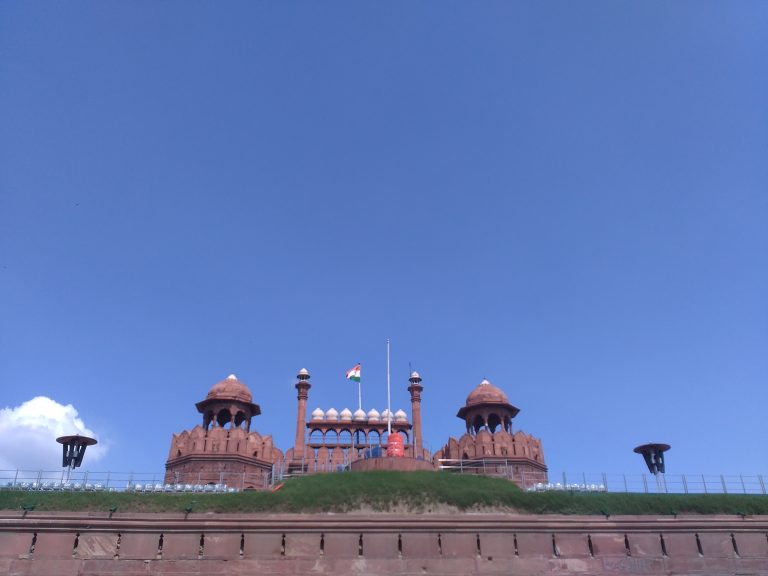
New Delhi under clear skies (representative image), Wikimedia Commons, CC BY-SA 4.0

Continue Reading

Weather

63 districts see above-normal rain as UP floods worsen

Heavy rain killed at least 10 people in Uttar Pradesh, with wall collapses and uprooted trees among the causes, as 63 districts recorded above-normal rainfall and schools were shut in several districts including Aligarh.

Published

on

Sixty-three districts across Uttar Pradesh recorded above-normal rainfall.

At least 10 people were killed in rain-related incidents, with 11 injured.

Standing crops and around 117 houses were damaged.

Schools were shut in several districts, including Aligarh, until Saturday.

The IMD has forecast continued heavy rain in parts of the state.

The state received about 19 times its normal rainfall in the 24 hours ending Saturday morning, according to reports.

Standing crops and around 117 houses were damaged by the heavy rain, thunderstorms and strong winds.

Paddy fields in districts including Jaunpur, Mirzapur and Azamgarh were among those affected.

Schools were shut in several districts, including Aligarh, where classes remained suspended until Saturday.

Some reports put the overall death toll higher, at up to 13-17 across the state, as rain-related incidents were still being tallied.

Rain that began after midnight on Thursday continued across most parts of the state through Friday and into the weekend.

Eastern Uttar Pradesh was forecast to see heavy rain on September 27, while western Uttar Pradesh was placed under a very heavy rainfall warning.

The IMD also flagged thunderstorms and lightning risk alongside the rain warnings.

Opposition leaders in the state have raised questions about infrastructure preparedness during the heavy rain spell.

State disaster relief teams have been deployed to assist with clean-up and relief work in the worst-affected districts.

Waterlogging disrupted traffic and daily life in several cities across Uttar Pradesh during the rain spell.

Local administrations have been assessing damage to houses and crops to process compensation claims for affected families.

Uttar Pradesh is India’s most populous state, and heavy rain events there routinely affect large numbers of people across multiple districts simultaneously.

The state government has set up helpline numbers in some districts for residents to report rain-related damage or emergencies.

Heavy rain in Uttar Pradesh killed at least 10 people, with 11 others injured, according to state officials.

Flooded road after heavy rain (representative image), Wikimedia Commons, CC BY-SA 4.0

Continue Reading

Weather

Same Bay of Bengal system, new warning: Telangana braces for rain

The IMD issued a heavy to very heavy rain warning for several Telangana districts, including Hyderabad, for September 24-25, as the same Bay of Bengal weather system that brought extreme rain to Odisha and Andhra Pradesh a day earlier moves further inland.

Published

on

The same deep depression that caused Tuesday’s extreme rain warnings for Odisha and Andhra Pradesh is now affecting Telangana.

The IMD has issued a heavy to very heavy rain warning for several Telangana districts, including Hyderabad, for September 24-25.

The system had earlier crossed the coast near Kalingapatnam in Andhra Pradesh.

Farmers in affected districts have been advised to take precautions for standing crops.

The IMD continues to update its warnings as the system moves.

The IMD’s warnings typically remain in place until a weather system weakens or moves out of the affected region.

Deep depressions over the Bay of Bengal often continue to produce rain over inland districts for a day or two after making landfall.

Local authorities in Telangana have been monitoring low-lying and flood-prone areas as the rain warning remains in place.

Residents in the affected districts have been advised to avoid waterlogged roads and stay updated on local weather alerts.

The system had earlier crossed the north Andhra Pradesh-south Odisha coast near Kalingapatnam.

Telangana and neighbouring states often see spillover rainfall from Bay of Bengal weather systems during the post-monsoon period in September and October.

The India Meteorological Department continues to track the system’s movement and update its warnings accordingly.

Farmers in the affected districts have separately been advised to take precautions for standing crops during the rain spell.

Weather warnings of this kind are issued in coordination with state disaster management authorities.

Hyderabad’s civic authorities have drainage and desilting measures in place ahead of the monsoon and post-monsoon rain spells each year.

The IMD categorises rainfall warnings using a colour-coded system, ranging from green to red depending on severity.

The IMD issued a heavy to very heavy rain warning for several Telangana districts, including Hyderabad, for September 24 and 25.

The warning follows an extremely heavy rainfall alert issued for Odisha, Andhra Pradesh and Telangana a day earlier, on September 23.

Bay of Bengal weather system (representative satellite image), Wikimedia Commons, public domain

Continue Reading

Trending