Connect with us

Weather

IMD issues 19-state heavy rain alert, warns of flash floods

The IMD has issued heavy rain alerts for 19 states, warning of flash flood risk in Jharkhand, Uttar Pradesh, Himachal Pradesh and Uttarakhand, with gusty winds up to 65 km/h.
Published

on

The IMD has issued a heavy rain alert covering 19 states, warning of flash floods in several parts of the country.

Jharkhand, Uttar Pradesh, Himachal Pradesh and Uttarakhand face the sharpest flash flood risk, with heavy to very heavy rainfall forecast.

Gusty winds of up to 65 km/h are also expected in several regions alongside the rainfall.

The Himalayan states of Uttarakhand, Himachal Pradesh and Jammu and Kashmir face a moderate to high risk of landslides during the alert period.

A well-marked low-pressure area over northeast Madhya Pradesh and its neighbourhood is behind the current spell of heavy rain.

The IMD flagged a moderate to high risk of landslides in the Himalayan states of Uttarakhand, Himachal Pradesh and Jammu and Kashmir given the intensity of the forecast rainfall.

The alerts are linked to a well-marked low-pressure area positioned over northeast Madhya Pradesh and its neighbourhood, which is driving the current spell of heavy rain.

Delhi is also expected to see a change in weather conditions as the wider system moves across north India in the coming days.

Authorities in the affected states have been advised to remain on alert, particularly in low-lying and landslide-prone areas where the risk of disruption is highest.

This marks one of the broader IMD alerts issued this monsoon season, spanning nearly the length of the country from the Himalayan foothills to central and eastern India.

The IMD warned of flash flood risk and heavy to very heavy rainfall across Jharkhand, Uttar Pradesh, Himachal Pradesh and Uttarakhand, with the four states facing the sharpest impact.

Gusty winds of up to 65 km/h are expected in several regions alongside the rainfall, adding to the risk of disruption in the affected areas.

Uttarakhand, Himachal Pradesh and Uttar Pradesh are bracing for intense downpours along with thunderstorm and lightning warnings through the alert period.

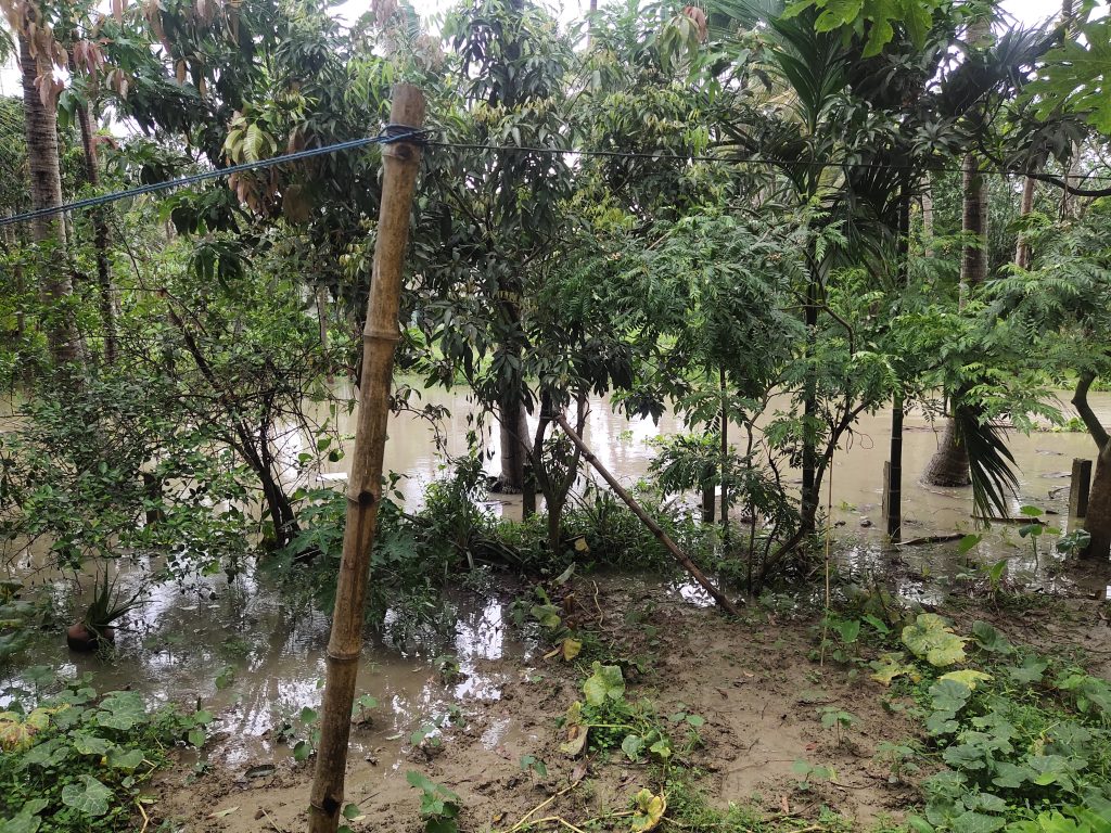
Wikimedia Commons, CC BY-SA 4.0 (representative monsoon flooding image)

Weather

Same Bay of Bengal system, new warning: Telangana braces for rain

The IMD issued a heavy to very heavy rain warning for several Telangana districts, including Hyderabad, for September 24-25, as the same Bay of Bengal weather system that brought extreme rain to Odisha and Andhra Pradesh a day earlier moves further inland.

Published

on

The same deep depression that caused Tuesday’s extreme rain warnings for Odisha and Andhra Pradesh is now affecting Telangana.

The IMD has issued a heavy to very heavy rain warning for several Telangana districts, including Hyderabad, for September 24-25.

The system had earlier crossed the coast near Kalingapatnam in Andhra Pradesh.

Farmers in affected districts have been advised to take precautions for standing crops.

The IMD continues to update its warnings as the system moves.

The IMD’s warnings typically remain in place until a weather system weakens or moves out of the affected region.

Deep depressions over the Bay of Bengal often continue to produce rain over inland districts for a day or two after making landfall.

Local authorities in Telangana have been monitoring low-lying and flood-prone areas as the rain warning remains in place.

Residents in the affected districts have been advised to avoid waterlogged roads and stay updated on local weather alerts.

The system had earlier crossed the north Andhra Pradesh-south Odisha coast near Kalingapatnam.

Telangana and neighbouring states often see spillover rainfall from Bay of Bengal weather systems during the post-monsoon period in September and October.

The India Meteorological Department continues to track the system’s movement and update its warnings accordingly.

Farmers in the affected districts have separately been advised to take precautions for standing crops during the rain spell.

Weather warnings of this kind are issued in coordination with state disaster management authorities.

Hyderabad’s civic authorities have drainage and desilting measures in place ahead of the monsoon and post-monsoon rain spells each year.

The IMD categorises rainfall warnings using a colour-coded system, ranging from green to red depending on severity.

The IMD issued a heavy to very heavy rain warning for several Telangana districts, including Hyderabad, for September 24 and 25.

The warning follows an extremely heavy rainfall alert issued for Odisha, Andhra Pradesh and Telangana a day earlier, on September 23.

Bay of Bengal weather system (representative satellite image), Wikimedia Commons, public domain

Continue Reading

Weather

Chhattisgarh under very heavy rainfall warning as depression nears coast

The IMD issued extremely heavy rainfall warnings for Odisha, Andhra Pradesh and Telangana on September 23, as a deep depression over the Bay of Bengal is set to cross the north Andhra Pradesh-south Odisha coast near Kalingapatnam by Wednesday night.

Published

on

Chhattisgarh has been placed under a very heavy rainfall warning as a deep depression approaches the Andhra Pradesh-Odisha coast.

Odisha, Andhra Pradesh and Telangana are under extremely heavy rainfall warnings for September 23.

The depression is expected to cross the coast near Kalingapatnam by Wednesday night.

The India Meteorological Department issued the warnings.

Local administrations have been asked to stay alert in low-lying, drainage-prone areas.

Coastal residents and fishermen were advised to treat marine warnings seriously and avoid venturing into the sea.

The IMD advised people to avoid waterlogged roads because of unpredictable depth and current.

People were also advised to seek shelter indoors during lightning and to stay away from open fields and isolated trees.

Local administrations in low-lying and drainage-prone areas were asked to stay alert.

The system follows an earlier spell of heavy rain over the same region on September 21-22, as the depression intensified over the Bay of Bengal.

Bengaluru was separately forecast to see thunderstorms with lightning and gusty winds of around 30-40 kmph.

Delhi-NCR was not under any rainfall warning for September 23.

The India Meteorological Department is the government’s nodal agency for weather forecasting and warnings.

Deep depressions of this kind are common over the Bay of Bengal during the post-monsoon and late monsoon period in September and October.

The IMD tracks such systems using satellite imagery, weather radar and a network of surface observation stations.

State disaster management authorities typically coordinate evacuation and relief measures in areas expecting extremely heavy rainfall.

Rivers and low-lying areas near the coast are especially monitored for flooding during such weather events.

The IMD updates its forecasts and warnings multiple times a day as a weather system evolves.

Agricultural authorities in affected states often issue separate advisories to farmers ahead of heavy rainfall events.

The India Meteorological Department issued extremely heavy rainfall warnings for Odisha, Andhra Pradesh and Telangana on September 23, 2026.

Bay of Bengal weather system (representative satellite image), Wikimedia Commons, public domain

Continue Reading

Weather

What is a deep depression, and why does it matter for the coast?

A low-pressure system over the Bay of Bengal is set to intensify into a deep depression on September 22, bringing heavy to very heavy rain to coastal Andhra Pradesh and Odisha, with winds gusting to 70 kmph.

Published

on

A low-pressure system over the Bay of Bengal is set to become a deep depression on September 22.

The system is expected to bring heavy to very heavy rain to coastal Andhra Pradesh and Odisha.

Winds in the Bay of Bengal could gust to 70 kmph.

Fishermen are advised not to venture into affected waters.

The system could further influence weather over the following days.

Heavy to very heavy rainfall is expected over coastal Andhra Pradesh and Odisha between September 22 and 24.

Heavy rain is also forecast over Chhattisgarh, Gangetic West Bengal, Karnataka, Maharashtra, Telangana and parts of the Northeast.

Jharkhand is expected to see heavy rain with thunderstorms and lightning on September 22.

West Bengal and Sikkim are forecast to see thunderstorms, lightning and squally conditions.

West Madhya Pradesh is under a thunderstorm and lightning warning.

The latest bulletin did not include warnings for Delhi-NCR, Uttar Pradesh, Punjab, Himachal Pradesh, Jammu and Kashmir, or Rajasthan for September 22.

Delhi is expected to remain mainly clear, with a maximum temperature of around 35 degrees Celsius and a minimum of about 24 degrees.

Heavier rain and thunderstorm activity is expected to reach Uttar Pradesh from around September 24-25.

Fishermen have been advised not to venture into the Bay of Bengal in areas affected by the strengthening system.

Forecasts for weather systems like this can change as the system develops, so people in the affected coastal areas are advised to follow updated bulletins.

A low-pressure area over the east-central Bay of Bengal and adjoining north Andaman Sea intensified into a depression around September 21.

The India Meteorological Department expects it to strengthen further into a deep depression on September 22.

Winds over parts of the Bay of Bengal could reach 50 to 60 kmph, gusting to 70 kmph, on September 22.

Tropical cyclone over the Bay of Bengal (NASA, representative image), Wikimedia Commons, public domain

Continue Reading

Trending